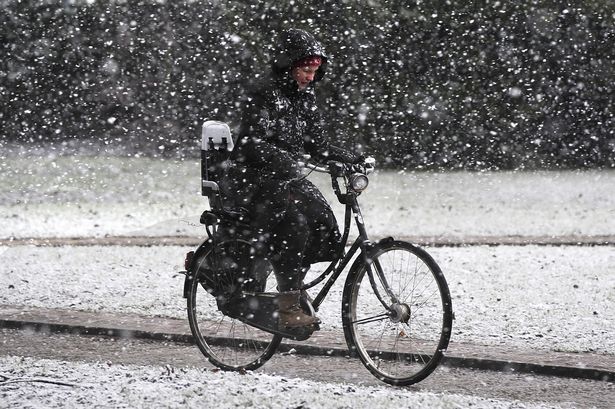
Tonight, parts of England are anticipated to experience a unique meteorological phenomenon: snow grains. Unlike typical snowflakes, which are crystalline and often intricate, snow grains are small, opaque ice particles, more akin to tiny pellets of snow. They form under specific atmospheric conditions and generally indicate a cold and stable air mass. While not accumulating significantly, their presence signals near-freezing temperatures and reinforces the expectation of a chilly night ahead for many across the region. The Met Office’s prediction of temperatures nearing freezing highlights the continuing influence of cold air, likely originating from polar or northerly regions, impacting the British Isles.
This cold snap, bringing with it the potential for snow grains, is part of a larger weather pattern affecting the UK. Recent days may have seen fluctuating temperatures, but this shift towards colder conditions indicates a transition to a more wintry regime. While widespread snowfall is not predicted with this particular weather system, the presence of snow grains serves as a reminder of the season and the potential for more significant wintry weather in the coming weeks. The specific areas likely to experience snow grains are mainly those exposed to the coldest air, typically higher ground and locations further north. However, even lower-lying areas could witness this unusual form of precipitation if temperatures drop sufficiently.
The formation of snow grains requires a specific combination of atmospheric conditions. They typically originate within relatively shallow layers of clouds containing supercooled water droplets. These droplets, existing in a liquid state below freezing, require a nucleus – a tiny particle – to initiate freezing. When these supercooled droplets encounter ice crystals or other suitable nuclei falling from higher cloud layers, they freeze upon contact, forming the small, opaque ice pellets known as snow grains. The size and concentration of these grains depend on the availability of supercooled water and the number of ice nuclei present. Their appearance often precedes or accompanies other forms of wintry precipitation, giving an indication of the atmospheric conditions favoring ice formation.
The Met Office’s forecast of temperatures close to freezing underlines the importance of preparation for potentially hazardous conditions. For motorists, this means ensuring vehicles are winter-ready, with appropriate tires and antifreeze levels. Pedestrians should be mindful of icy patches, particularly on untreated surfaces, and dress warmly for the prevailing conditions. Homeowners are also advised to take precautions to prevent frozen pipes, especially in exposed or poorly insulated areas. Checking on vulnerable neighbors and ensuring adequate heating is available can also mitigate the risks associated with cold weather.
The prevalence of colder temperatures across England has several implications beyond the immediate forecast. It can impact energy demand as households increase heating usage, potentially leading to higher energy bills. Agriculture and horticulture can also be affected, with crops and livestock requiring protection from frost and freezing conditions. The cold weather can also influence wildlife, prompting changes in behavior and migration patterns. Furthermore, the icy conditions can pose challenges for transport networks, potentially leading to delays and disruptions. Monitoring weather forecasts and taking appropriate precautions are crucial for mitigating these impacts.
Looking ahead, while this specific weather event featuring snow grains is expected to be relatively short-lived, the broader trend of colder temperatures is likely to persist in the coming days. The Met Office and other meteorological agencies will continue to monitor atmospheric conditions and provide updated forecasts, allowing for appropriate planning and responses. Staying informed about weather developments and heeding advice from relevant authorities remains essential for navigating the challenges of winter weather and ensuring safety and well-being. The possibility of further wintry precipitation, including snow, cannot be ruled out as the season progresses, and vigilance and preparedness are key to minimizing disruption and potential risks associated with such events.


