



From Scorching Skies to Soaking Showers: Britain’s Weekend Weather Shift
After a week of relentless, record-breaking heat that saw temperatures soar past 35°C, the United Kingdom is bracing for a dramatic and much-needed meteorological shift. The blistering heatwave that baked the nation, peaking at 31.8°C in Whitechurch, Pembrokeshire, is finally breaking down. In its place, a familiar and changeable British weekend is rolling in, promising to swap sunscreen for umbrellas for many. This transition marks the end of an intense period of high pressure and ushers in a more typical pattern of Atlantic-driven weather, bringing relief from the sweltering conditions but introducing its own set of damp and blustery challenges.
The change begins subtly on Friday, serving as a prelude to the weekend’s wetter weather. Cloud will spread across most of the country, muting the fierce sun and offering the first tangible hint of the cooling to come. This blanket of cloud is the advancing guard of a weak cold front, a boundary that will fundamentally reshape the nation’s atmospheric conditions. By sapping the intensity of the heat and increasing humidity, it sets the stage for the more dynamic and unsettled conditions forecast to follow, gradually easing the country out of its heat-induced stupor.
Saturday is when the transformation becomes unmistakable, particularly for those in the north and west. While the southeast may still enjoy a brighter start, a band of rain will gather momentum and push eastwards from the Atlantic. The rainfall will be heaviest and most persistent across Scotland, Northern Ireland, and parts of Northwest England, where some locations could see up to 20mm of accumulation. Specific areas like Dumfries and Galloway, East and South Ayrshire, Cumbria, Lancashire, Greater Manchester, Merseyside, and Cheshire are in line for the most intense downpours. In stark contrast, the southeast of England is expected to cling onto largely dry conditions until Sunday at the earliest, creating a stark national divide beneath the same sky.
This breakdown of the heatwave, as explained by Met Office chief forecaster Chris Bulmer, involves the cold front becoming established across the UK. The result is a significant drop in temperatures for most, bringing them closer to the seasonal average, though the southeast will linger in above-average warmth a little longer. The collision between the retreating heat and the advancing cooler, moister air also introduces the risk of showers and thunderstorms in places, adding a potentially lively element to the mix. The weekend, therefore, symbolises a return to equilibrium—a reset after an extreme climatic episode.
The unsettled theme is set to continue beyond Saturday. Sunday promises further bouts of rain and showers, again focused on northern and western regions, though brighter intervals may develop further east. Looking ahead, the Met Office indicates that this changeable, rain-bearing pattern is likely to persist into the following week. The era of exceptional heat has passed, replaced by a more typical and unpredictable rhythm of showers, sunny spells, and gentle temperatures that characterise a British late spring.
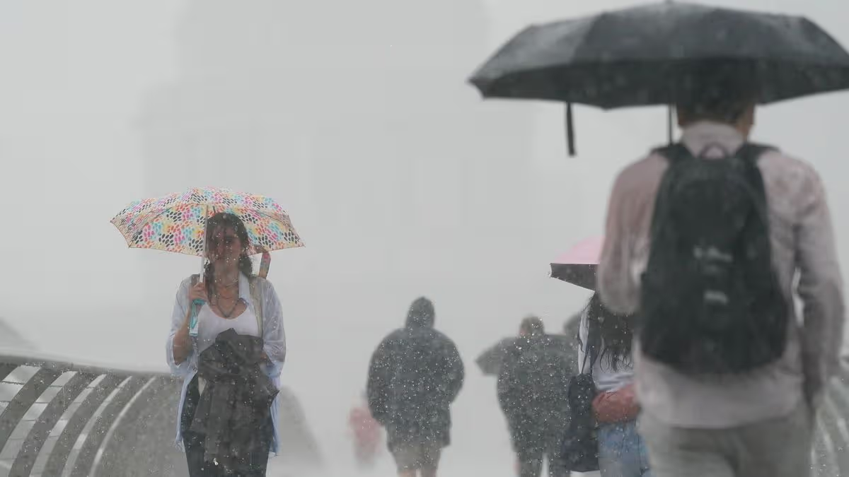
In summary, the nation is transitioning from a state of exceptional heat to one of familiar variability. The umbrella-toting figures on London’s Millennium Bridge, captured earlier in the week, foreshadowed the widespread return of rain. For the parched northwest, the coming rains will be a thorough drenching, while the southeast delays its farewell to dryness a little longer. It’s a classic British weather story: a dramatic shift that leaves no region entirely untouched, yet affects each with a different hand, reminding everyone of the island’s compelling and often capricious climate.