

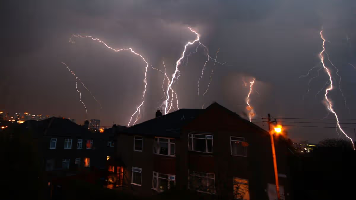


An Ominous Shift: From Record Heat to Ferocious Storms
After days of unprecedented, sweltering heat that felt more akin to a Mediterranean summer, the weather across the United Kingdom is set to take a dramatic and dangerous turn. The Met Office has issued a significant yellow thunderstorm warning for vast swathes of England and Wales, effective from 3 pm today through Tuesday night. This alert serves as a stark reminder of the volatile nature of our climate, as the atmosphere, overloaded with energy from the recent record-breaking temperatures, seeks a violent release. While many will continue to bask in hot sunshine, for those under the warning, the conditions will deteriorate rapidly, exchanging the threat of heat exhaustion for the immediate perils of intense electrical storms, large hail, and sudden, torrential downpours.
The Calm Before the Storm: A Record-Shattering Heatwave
To understand the severity of the impending storms, one must first appreciate the extraordinary heat that has baked the nation. This has been a meteorological spring unlike any other in recorded history. The country has just endured its warmest May night for a second consecutive day, with temperatures at Kenley Airfield in south London failing to drop below 21.3°C—a phenomenon known as a ‘tropical night,’ more common in subtropical climates. Furthermore, a provisional all-time hottest spring temperature was set on Monday when the mercury soared to 34.8°C at Kew Gardens. The heat is not relenting; forecasts for Tuesday suggest the May record could be broken again, with highs potentially reaching a staggering 36°C across southern England, the Midlands, East Anglia, and South Wales.
The Warning: A Broad Swathe of the Country on Alert
The thunderstorm warning is expansive, covering forty-two local authority areas and touching nearly every region of England. From Derby and Nottinghamshire in the East Midlands to Essex and Suffolk in the East of England, and from the bustling streets of London to the rural landscapes of Somerset and Wiltshire in the Southwest, communities are urged to be vigilant. The warning also encompasses the West Midlands, parts of Yorkshire, and areas in the Northwest. This is not a minor, isolated weather event but a widespread atmospheric reaction. The Met Office’s forecast is specific and alarming: isolated thunderstorms could unleash “frequent lightning, large hail, gusty winds and the potential for 30mm of rain in less than an hour.” The explicit note that “lightning may well be an additional hazard” underscores the serious risk to life and safety.
The Human Impact: From Inconvenience to Genuine Danger
For the millions living within the warning zone, the shift will be more than just a topic of conversation. It transforms a day of potential outdoor enjoyment into one requiring caution and preparation. Imagine families on half-term outings, workers on construction sites, farmers tending to livestock and crops, and commuters beginning their journeys home—all suddenly needing to reassess their plans. The primary hazards are multifaceted. Frequent lightning poses a direct risk to anyone outdoors, especially in open areas or near water. Large hail can cause significant damage to vehicles, windows, and gardens, and presents a personal injury risk. Gusty winds may bring down tree branches or cause power outages, while the intense, localized rainfall could lead to sudden flash flooding, turning roads into rivers and overwhelming drainage systems in a matter of minutes.
Navigating the Change: Practical Steps for Safety
In the face of such conditions, being prepared is key. The advice from authorities is clear: if you hear thunder, you are already within range of lightning and should seek shelter immediately in a substantial building or a hard-topped metal vehicle. It is crucial to avoid using landline telephones, electrical appliances, or plumbing during the storm, as lightning can travel through wiring and pipes. For those on the road, reducing speed and increasing distance from other vehicles is essential, as hail and standing water dramatically reduce traction and visibility. People should also secure loose outdoor items and, if possible, avoid travel during the peak of the storm activity. Staying informed via official Met Office updates and local news is the best way to track the evolution of these potentially cell-based storms, which can develop and move with little warning.
A Symptom of a Larger Pattern: Heat, Humidity, and Instability
This dramatic pivot from historic heat to severe thunderstorms is not a mere coincidence; it is a classic and potent meteorological sequence. The intense sunshine of recent days has not only heated the ground but has evaporated vast amounts of moisture into the lower atmosphere. This creates a hot, humid, and increasingly unstable air mass. As a slight change in the upper atmosphere occurs—often a cooler air mass or a triggering feature like a frontal boundary—the warm, moist air is forced violently upward. It rapidly cools and condenses, forming towering cumulonimbus clouds, the engines of thunderstorms. The greater the heat and humidity at the surface, the more energy is available, increasing the potential for these storms to become severe, with enhanced lightning, larger hail, and stronger winds. This event, therefore, stands as a powerful, real-time illustration of how extreme heat can be the precursor to extreme weather of a very different kind, leaving communities to brace for the dramatic and potentially disruptive conclusion to this remarkable spell of spring weather.