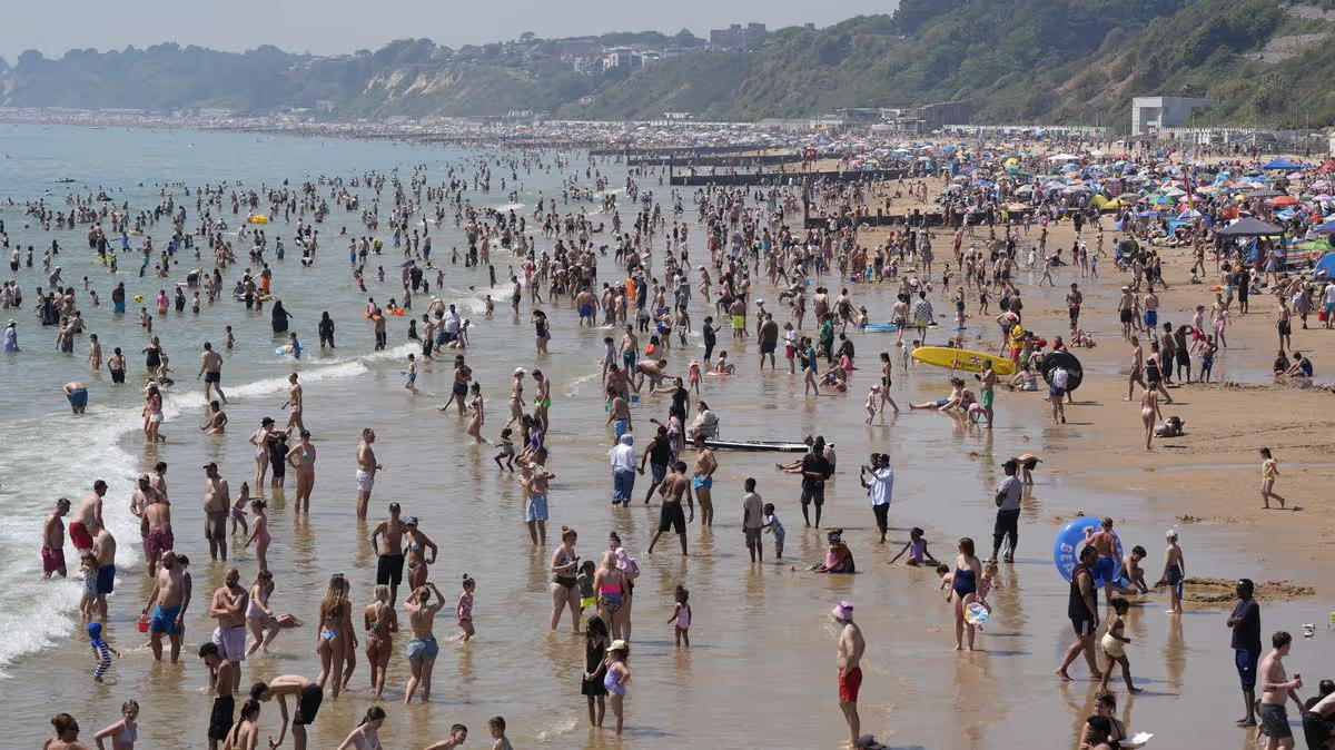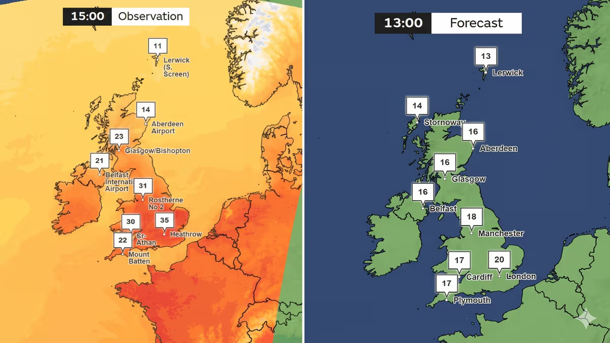




After a truly historic burst of early-summer heat, the United Kingdom is set for a dramatic and widespread cooldown, marking a sharp return to more typical and unsettled conditions. The Met Office has confirmed that this past Tuesday, the 26th of May, provisionally became the UK’s hottest May day on record, with temperatures soaring to 35°C at both Heathrow and Kew Gardens in London. This scorching peak followed a bank holiday weekend that had already shattered century-old records, as Kew Gardens hit 34.8°C on Monday, surpassing the previous high of 32.8°C set in 1922 and 1944. The nation has, in essence, experienced a fleeting but intense taste of midsummer, well ahead of the season’s official arrival.
For the remainder of this week, the heat will gradually loosen its grip, but conditions will remain largely pleasant. Wednesday is expected to be dry for most, with London still enjoying highs around 26°C, though cloud will increase in the northeast. From Thursday through Saturday, the south will continue to hold onto warm temperatures, but with the increasing risk of isolated thundery showers as the atmosphere becomes more unstable. This serves as the first hint of a significant pattern shift brewing on the horizon, a precursor to a much more changeable period of weather.
That decisive change is due to arrive from Sunday onwards, as the dominant high pressure that delivered the record heat finally breaks down. In its place, Atlantic weather systems will begin to sweep in from the west, heralding a return to the more familiar, unpredictable rhythms of British weather. The Met Office has explicitly warned of this “more changeable period,” which will introduce a mix of drier spells, scattered showers, and some longer spells of rain across the country. This shift signals the end of the extended dry, stable, and exceptionally warm conditions many have enjoyed.
The incoming Atlantic influence will not be felt equally across all regions. Northwestern areas, including parts of Scotland and Northern Ireland, are likely to bear the brunt of this changeable pattern, facing the heaviest rain and the breeziest conditions. In contrast, southern and eastern England may still see the best of any drier and brighter interludes, though they will not escape the showers entirely. Temperatures overall will return to near-normal for early June, a stark contrast to the recent extremes, with any lingering warmth most probable in eastern counties.
This pronounced temperature drop is vividly illustrated by the Met Office’s forecast maps for next Tuesday, the 2nd of June. They show a landscape transformed from the balmy highs of 35°C to readings more reminiscent of late spring. Southern England and Wales, for instance, are predicted to see afternoon temperatures only in the late teens, with perhaps 20°C in the southeast. Further north, across northern England, Scotland, and Northern Ireland, it will feel notably cooler, with highs hovering around the mid-teens. It will be a reminder to dig out light layers that had been hastily stored away.
Ultimately, this forecast underscores the dynamic and often unpredictable nature of the UK’s climate, capable of swinging from record-breaking heat to cool, showery conditions within a matter of days. While the coming week may lack the dazzling sunshine of late, it represents a return to seasonal normality after an extraordinary meteorological interlude. It’s a classic British reset—a reminder to keep both sunglasses and an umbrella close at hand as we transition into June.